On a glorious morning, my final glance over Cooper Creek as we crossed the bridge was one to remember. Then I was bound to get one last picture of a dry channel. Many roos were out and about and bounding away from us.
click on pix to see them big
Twenty-six kilometres east of Windorah is a dry-weather-only track, signposted to Hammond Downs and Welford National Park. For the most part it runs parallel to the Barcoo River. The landscape was pretty bare, most of it having being eaten by cows I suspect. There were frequent vermin fences and dire warnings.
At Retreat Station we joined the Jundah-Quilpie Road. In case we weren't sure we'd got there, there was a nice big sign.
Soon we came to the Barcoo River and stopped for a picnic breakfast. The source of the Barcoo is in the Warrego Range, roughly 200 km north of Charleville: the river flows west to join with the Thomson to form Cooper Creek. The first European to find it was Major Sir Thomas Mitchell – of cockatoo fame – in 1846. He was Surveyor General of New South Wales and on his fourth expedition from Sydney, in search of a great northward-flowing river in the interior. The Barcoo has often been the subject of poetry, being generally considered to be at the at the very edge of civilisation. Beyond the Barcoo is even further into the middle of nowhere than back o' Bourke, I believe. Bush poet Banjo Paterson – of
Waltzing Matilda fame – wrote in 1893:
'On the outer Barcoo where churches are few,
And men of religion are scanty,
On a road seldom crossed 'cept by folk that are lost,
One, Michael Magee had a shanty...'
And an anonymous writer wrote even earlier:
'To carry me westward ho, my boys, that's where the cattle stray
On the far Barcoo where they eat nardoo*, a thousand miles away!'
Rivers in this region have a strange, other-worldly feel that's difficult to define. There's a quietness and a sense of unreality that I suppose results from remoteness and the fact that it's so dry they shouldn't be there at all. The only sign of life on the Barcoo was an opportunistic Black Kite circling over an unfortunate kangaroo that had recently met its maker on the bridge. How could anyone have been driving that fast at that point?


Beyond the crossing is Welford National Park. Back east, so many national parks are full of tall trees that the prospect of a deserty one was thrilling. I would have liked to do the Mulga Drive and view the panorama from Sawyer's lookout. But the River and Desert drives link up with the Jundah-Quilpie Road further north, the direction in which we were headed, and desert was what I'd come for. As we started out along the River Drive a truly remarkable sight made us gasp. We'd seen large flocks of Little Corellas before, but this was a cloud, hundreds moving as one; first this way, then that; light, and then darker, like shoals of silvery fish. They were moving away from us, and eventually seemed to go to ground, so I drove in that direction, quickly, hopeful of a better view. Then they rose again, nearer to us this time. Thank goodness for the rapid-fire shooting mechanism on my friend's camera. An experience to lift the spirits.


And then, four Spinifex Pigeons. Welford National Park was living up to expectations. The River Drive obviously took us back to the Barcoo and 'The Jetty'. In the next little while we crossed a series of dry and dusty flats and came by the occasional waterhole. By midday at the Desert Waterhole it was a pleasantly warm 23 degrees.
One roo thought we couldn't see him.
Then things became a lot sandier. And there were sand hills to climb.
The Ghost Gums were striking against the desert sand and sky.
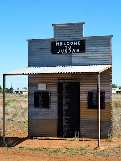
Oil Bore was sunk 2500 metres in 1986. These days it brings water up from 1800 metres. Soon afterwards we left the lovely Welford NP. The Jundah-Quilpie Road was horrible by comparison – wide, rough and roadworky. We remarked how the vegetation in the Park had seemed so complete, there being no cattle in there to eat it or trample it down. Thirty kilometres north, we ate our lunch on the banks of the Thomson River at Jundah, the administrative centre of Barcoo Shire and more than 1100 kilometres west of Brisbane. It's long been a centre for pastoralism but also had a brief opal boom at the beginning of the 20th century. The name means woman in a local Aboriginal language. I like this style of welcome sign.

Just outside Jundah I got the only picture of a feral cat I managed on the whole trip: it had clocked me and was making its getaway. On the Thomson Developmental Road between Jundah and Stonehenge, Swanvale Jump-up provides a high point in a region of otherwise featureless plains and a rare lookout. It is topped by a harder rock than the surrounding plains that has resisted erosion.
Stonehenge got its name from an old stone hut in which bullock drivers spent the night until it fell into ruin. You have to make a slight detour off the main road to get into town. We had a quick brew by the Thomson, but here it was less of a river than at Jundah; more a series of messy, stony intermittent channels.
Time was getting on: it was 4 pm and Longreach was still 150 kilometres away. Soon we were driving across an open treeless plain which helped speed us up as roadside roos and other animals were more easily visible in the fading light. But dark Western Greys could pop up and surprise. There were two more tabby ferals by roadkill and a massive dead cow. I suddenly screeched to a halt when my friend spotted four Australian Bustards, which we'd been hoping to see for days. We got quite close before they took flight. How haughty they are, 'noses' in the air, and they're big birds (0.8-1.3 metres tall).


The sunset was extraordinary. A big advantage of flat plains is that such a light show can extend almost all around you. The colours ranged from yellow to pink to turquoise to orange to deep red to purple. It was breathtaking, and impossible to photograph adequately. It may have been the best sunset I've ever witnessed, and I didn't want it to end. It was completely dark by the time we reached Longreach, slowly. It was by far the biggest town we'd seen in a while and I wasn't happy about that.
*
resembling clover or waterlily, nardoo is in fact related to the fern family. It grows in water or wet ground but can survive hot dry summers, seemingly dead, before springing into life come the rains


No comments:
Post a Comment