Go west to Windorah and the heart of the Channel Country. There I could fully indulge my fascination with ephemeral waterways.

About 40 kilometres west of Quilpie we turned on to the Diamantina Developmental Road. For a while there were barely noticeable landscape changes apart from an overall increase in sandiness and the first sand hill. We spotted our first feral cat, sharing roadkill with an eagle. It was a grey tabby and no bigger than a domestic cat. I'm not sure why I'd imagined feral cats would be bigger. I've probably read far too many fanciful reports of large feral cats roaming isolated regions. We wondered, had there not been dead meat by the roadside, whether the cat would have been prey to the eagle. Shortly afterwards there was another cat, and then another – ginger this time – by Kyabra Creek. I parked hurriedly and stalked, hoping to get a photo, but the cat had too much of a head start and disappeared into undergrowth. The subject of feral cats in Australia is a big one that provokes highly polarised opinions and debate about eradication – and requires its own post at a later date.
Kyabra Creek flows into Cooper Creek. It is 155 kilometres in length but drops only 23 metres over its course and flows through 9 major waterholes.
Talking of ferals, this caught our eye further on. Wild dogs are also a problem in these parts – as are pigs, goats, rabbits, foxes and more – but obviously these two no longer pose a risk to native fauna or stock.
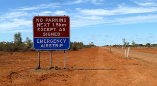
Quilpie Shire became Barcoo Shire, Barcoo being the name of the river that joins with the Thomson to form Cooper Creek. We came across a different use for the road. Good idea, except at night I suspect white lines aren't quite as effective as landing lights.

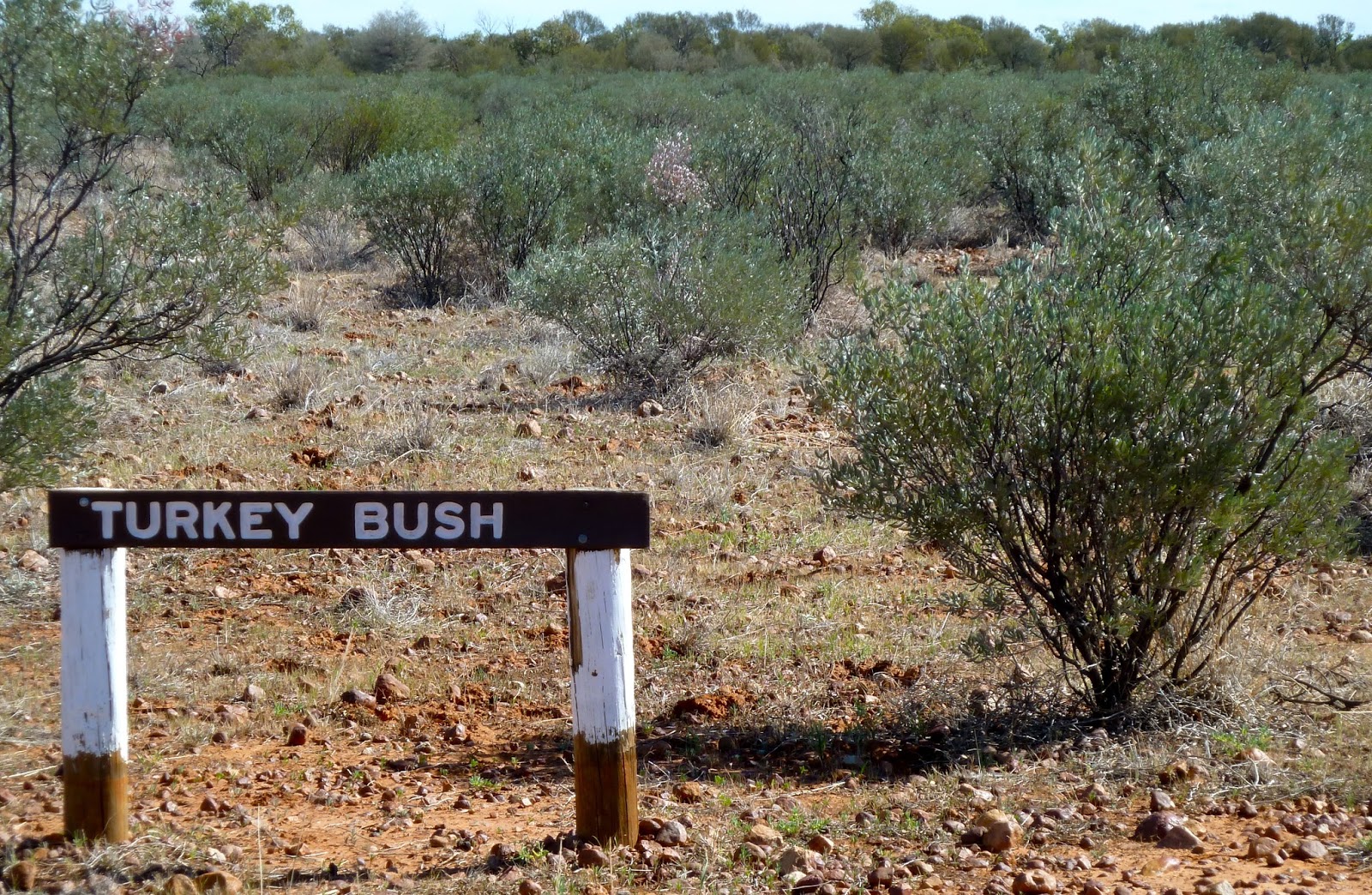
In the Channel Country there are series of empty creeks at this time of year. They are tree-lined and easily identified in the midst of a sparsely vegetated landscape. There are dips in the road marked as floodways, so it's a bit like a mild rollercoaster ride. The main species lining the creeks are River Red Gum, Coolibah, River Tea Tree and wattles. Other plant communities of the Cooper Creek floodplain include lignum shrubland on the clay pans; gidgee low open woodland beyond the flood level; and spinifex hummock grassland – which incorporates mulga, bloodwoods, grevilleas and turkey bush – on the sand plain above the flood plain. All these communities support varied wildlife; but little of it was in evidence when we were there. You can't win in this part of the world: obviously there are more animals to be seen when the creeks are in flood; but you can't get about when the tracks are inundated.
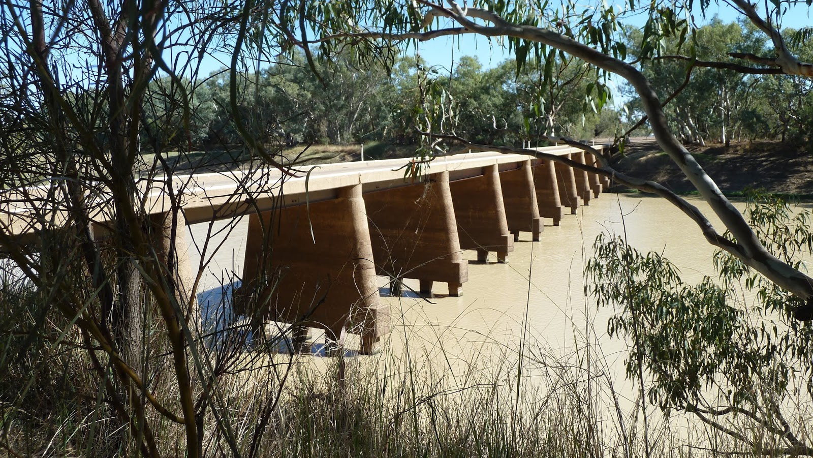
We crossed over Deadman Channel Bridge before reaching Cooper Creek. Dead Horse; Dead Man; they're very popular names in the bush, I've found. And rest assured, there will have been a dead horse or a dead man there once upon a time.

There was a lot more water in Cooper Creek, especially for arid country. Cooper Creek's greatest claim to fame is that Burke and Wills, probably Australia's best-known explorers, died nearby on their return leg across the continent (Melbourne to the Gulf of Carpentaria). My fascination with the place could come from avidly reading about explorers' struggles for survival, or perhaps because I associate the name with Queensland's remote west. I love remote. Amazingly, Cooper Creek is 1300 kilometres long, the second longest system (after the Murray-Darling) in Australia; and it is one of four main drainers* of the Lake Eyre Basin. Its flow is dependent on monsoonal rainfall far far away in eastern regions of Queensland. Some years, after a particularly wet Wet, the Creek will flood several times: in dry years, it will consist of little more than a chain of ponds.


Despite a more than adequate camping area, a group of grey nomads had parked themselves right down by the water's edge, complete with satellite dish, boat and multiple camping gadgets. They rather spoilt the southward view but they didn't deter the birds around McPhellamy's Crossing, where the Cooper Queen used to ferry across the Creek before the bridge was built in 1949. White-necked Herons are partial to fish, frogs and yabbies (crayfish) along the Creek.


Cooper Creek is 11 km from Windorah but we didn't continue along the Diamantina Developmental Road. We took Old Man Road, a track dating from before 1952 (so the sign said) which is now a 12-km Nature Drive. Forty trees and shrubs are signed along the way: once you start photographing them as part of your great Australian trees education programme, you have to finish, of course. The Drive gives you a good feel for the region's landscape. I think caravaners and trailer-pullers may have been put off by the gully near the start because we were gloriously alone.
Spot the stick insect.
There were a lot of Spotted Fuchsias – aka Emubush – and they were full of flowers, which was rather a surprise for someone from a temperate zone. Cows eat Emubush, but no surprises there.
For many people Spinifex and red soil = Outback.
Towards the end of the track we wondered if this was another joke, but in fact it's a prickly wattle that is often said to be the last plant standing during serious drought.
And then a surprise as we were approaching Windorah – a solar farm. Five dishes standing in a row, each one 13.7 metres in diameter and lined with 112 mirrors, concentrating sunlight on to a high-capacity photovoltaic cell above the centre of the dish. The farm can generate 360,000 kilowatt hours of electricity a year which supplements power from diesel generators in Windorah – population about 100. If only there were more such schemes, taking advantage of Australia's sunny climes rather than its coal and gas deposits.
Twelve kilometres west of Windorah on the Birdsville road are sand hills of a deep deep red, especially as the sun goes down. They don't look very high but there are great views from the top, of sandy hills and plains to one side, the north, and of the Cooper Creek floodplain to the south. There was, naturally, endless scope for photography.
This is a pie melon, I think; a type of squash. We'd seen them before, in Charleville. How can such a water-filled vegetable grow in the desert?


I liked Windorah: it may even have been my favourite place. It was founded on a stock route in 1880, and the name means big fish in a local Aboriginal language. We found a new type of bottle tree, the Kurrajong, which is broadleaved and dry-season deciduous. (Spot the ACD in the corner of the pic below.) Albert Street, where we stayed in the Western Star Hotel, had a tree-filled median strip that included bottle trees, and an interesting shop I was surprised wasn't open. When you're travelling you lose all track of the days: it was Sunday. Our Saturday night excitement had been a barbie in the garden of the Western Star. We chatted to fellow guests around a huge fire in an old coal washing screen. It was mighty cold: glovies, scarf and coat weather for the bits not facing the fire. The conversation turned to the treatment of Julia Gillard while she was PM, and there seemed to be unanimous condemnation among the group although their backgrounds were disparate.


Next morning we were up and off quite early in order to maximise national park time. It was a beautiful morning.
*
the others are the Diamantina, Georgina and Finke


No comments:
Post a Comment